Traffic Impact and Modelling – Notes from Workshops 1 and 2

My York Central – workshops on traffic impact and modelling – 14th and 20th September 2018

Introduction by Tony May

This and the planned subsequent workshop came from questions raised at previous workshops, suggesting there were questions from the public about the modelling assumptions and data. The aims of the session are:-

  1. To inform comments on the current and imminent planning applications (and it was pointed out that all comments / objections / etc should be directed to the planning authority, not to Arup /Tony / MYC)
  2. To frame possible further public input following approval of the application.

It was discussed/agreed that further modelling could not be carried out at this time (current data forms part of planning application, and Arup have no brief to carry out further work) but that existing modelling may easily yield further information, if requirements can be identified.

Notes taken during workshop 1 presentation 14th September 2018 by Anna Vickers.

The modelling approach uses a SATURN model of traffic movements for a morning peak hour and an evening peak hour. The base year is 2016/17, but they have used CYC’s 2033 model, which includes all of the effects of draft Local Plan developments and known road improvements such as the outer ring road. Their “do-minimum” has York Central and its access road stripped out; “do-something” involves adding it, with the assumptions described below.

Question about 2033 conditions: it was noted that the “do-minimum” reflects high levels of congestion resulting from the new developments anticipated in the Local Plan.

Assumption 1: The access road is provided, with the three variants for the Leeman Road Tunnel.
Assumption 2: Existing vehicle trips are maintained. This doesn’t mean parking is being re-provided for all uses. Approach was agreed with CoYC.
Assumption 3: Modelling based on max residential and max commercial development numbers combined (More than is actually possible). Arup are able to provide actual maximum combined possible numbers.
Assumption 4: Overall trip rates from new developments are estimated. Trip rates used are based on existing survey data for journeys made and modes used. CYC specified this approach.
Assumption 5: Total trip numbers from all new developments are calculated. While estimates of journeys for all modes are generated, only car trips are included in the model.
Assumption 6: Trips are assigned destinations, so that they can be loaded onto the network. This uses the approach adopted by CYC for the Local Plan.

Questions/responses re multi-storey car parks (MSCPs):- One is for station which is to replace part of existing provision and one is new provision for commercial development.

Point made re downsides of building more car parking (air quality etc) – Phil White explained rationale for number of spaces to be provided. TM summarised discussion:-
1. Should we replace existing parking like-for-like?
2. Much of the current car parking on York Central is associated with car-related business (hire, fleet, etc) which will go when site is developed.
3. Assumptions are being made about required provision for commercial development.

Questions/response re mode shares assumed in modelling. Vehicle (driving or passenger) split is 37% + 4% for residential area and 34% + 5% for commercial area. Question raised about mode share and CoYC policy; Trip rates and mode shares are based on standard methodology. Residential trip rates on surveys at nearby Phoenix Boulevard, commercial trip rates based on national database. Mode share is from 2011 census data. Trip rates don’t take into account future reductions in car trips resulting from policy changes.

Also noted modelling is separate from process of design. Parking spaces determined on basis of benchmarking of CoYC policy and recent developments across other cities, all in agreement with CoYC.

Question on variable traffic conditions: the model represents an average weekday.

Question on potential for reducing car use: the approach does not attempt to reflect the effect of other transport policies. It is thus a worst case assessment.

Anna Vickers then presented the results generated for Options 1, 2 and 3.

Impacts on ring road were discussed; uncertainty about how much impact any increased numbers represented (actual base figures not shown).

Difference in impact between Option 1 (Leeman Road tunnel as is) and Option 2 (Leeman Road tunnel revised to give signalised single vehicle lane) insignificant, so Option 1 dismissed as Option 2 gives benefits to walking/cycling.

Diagrams showing modelling of specific journey delays for vehicles on Poppleton Road / Holgate Road and Clifton / Bootham discussed. Again no assumption of mode shift. However, Arup view is that mode shift would be influenced by a number of factors and the modelling cannot definitively be stated to be an “over estimate” at this time.

Concluding discussion about further information requested:-

Lindsay Cowle asked about Bootham/Gillygate junction and modelling.

Dave Merrett asked about modelling for Lendal Gyratory.

Jonathan Tyler asked about strategic level issues:- the modelling shows there will be impacts on the city as a whole, but what can/will CoYC do? TM noted that York Central issues are actually Local Plan issues – all already evident in the 2033 “do minimum” analysis. DM commented that he felt all modelling for any planning applications will be based upon a deficient Local Plan.

Following the meeting TM drafted a list of requests for further information:-

  1. volume-capacity ratios in both peaks in the base and options 2 and 3 for their junctions 1, 4-13, and the five additional junctions: Bootham/Gillygate; Lendal Gyratory (two junctions); Clarence St/Lord Mayor’s Walk; Walmgate/Lawrence St (the latter two to show any impacts of re-routing around the inner ring road);
  2. the data on “impacted” junctions split by whether the impact is a 50 veh/h flow increase and/or a volume/capacity ratio of over 80% again for both peaks for the base and options 2 and 3;
  3. select link analyses either inbound in the am peak or outbound in the pm peak for Poppleton Rd, the new access road and Clifton, again for the base and options 2 and 3;
  4. pcu (passenger car unit)-km for the whole network for both peaks for the base and options 2 and 3 (to complement the data which they have already provided on delays and travel times);
  5. pcu-km, pcu-h and pcu-h in delay for the area within a cordon surrounding York Central and the city centre, for both peaks for the base and options 2 and 3 (to provide a clearer idea of changes in levels of congestion in the immediate area).

Anna Vickers had indicated that all of these should be possible, but later confirmed that (5) would take longer to produce and would not be available for the next meeting.

TM noted that Arup’s excellent presentation included more information than in the Transport Assessment. Phil White agreed urgently to check whether the presentation could be circulated and, if so, to do so as input to the subsequent meeting on 20th September.

DM and TM (and all present) noted appreciation for the work put in by Anna Vickers / Phil White / Susie Bathe in preparation for both these workshops.

…and here is a link to the Powerpoint presentation used by Susie during workshop 2 – which includes the presentation used by Anna during workshop 1 (many thanks to Arup for providing this and York Central Partnership for authorising its use):- Traffic modelling workshop 1-2 PPT
Two workshops looking at traffic impact and modelling

A chance to understand the work being done to look at traffic impacts, and to question the assumptions on which it is based.

One of the eight big ideas which came out of public input at the Festival of York Central was “People, not Cars”. There has been a huge amount of discussion about how York Central Partnership’s aim of encouraging sustainable transport and reducing car use can be made real in the masterplanning proposals, and this has included debate about segregated walking and cycling routes, parking provision and location, and connections with the existing road network.

A central question in this latter issue has been around Leeman Road tunnel and whether this should be open to general vehicular traffic or restricted largely to busses and taxis. This effectively makes the main spine road either a through route or an access-only route into York Central. The importance of this decision has been acknowledged by traffic engineers at Arup having been commissioned to carry out extensive traffic modelling, which has informed the current outline planning application.

Like all modelling, the predictions are built upon assumptions – about future trends, human behaviour, implementation of planning policy. These are technical issues but also ones where residents of the city may have their own views, based upon their own experience and expectations.

We have set up two public evening workshops to give people with an interest in transport and movement – or simply wanting to know the impacts on their part of the city – a chance to get involved.

The first, at 6:00pm – 8:00pm on Friday 14th September in the Clementhorpe Room at Priory Street Centre, is a chance to look at the current traffic modelling in more detail with guidance from Professor Tony May, and to jointly develop understanding and questions about this, and propose alternative future scenarios for investigation.

Please book your free ticket using Eventbrite here.

The second, at 6:00pm – 8:00pm on Thursday 20th September in the Penn Room at Friargate meeting house, will be for the transport engineers at Arup to report back on findings from the alternatives and to discuss the implications and possible next steps which they suggest. Professor Tony May will again assist with interpretation.

Please book your free ticket using Eventbrite here.

Movement: York Central Outline Planning Application Workshops

Movement workshops, July 2018.

Two workshops were held to explore the Movement in the Outline Planning Application, 18th July 2018 and 30th July 2018..

The first introduced the movement options here.

The second was a chance to investigate the different issues in more detail. You can read the notes from this event here.

York Central Transport and Access – Professor Tony May

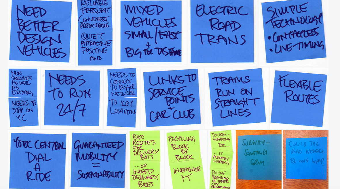
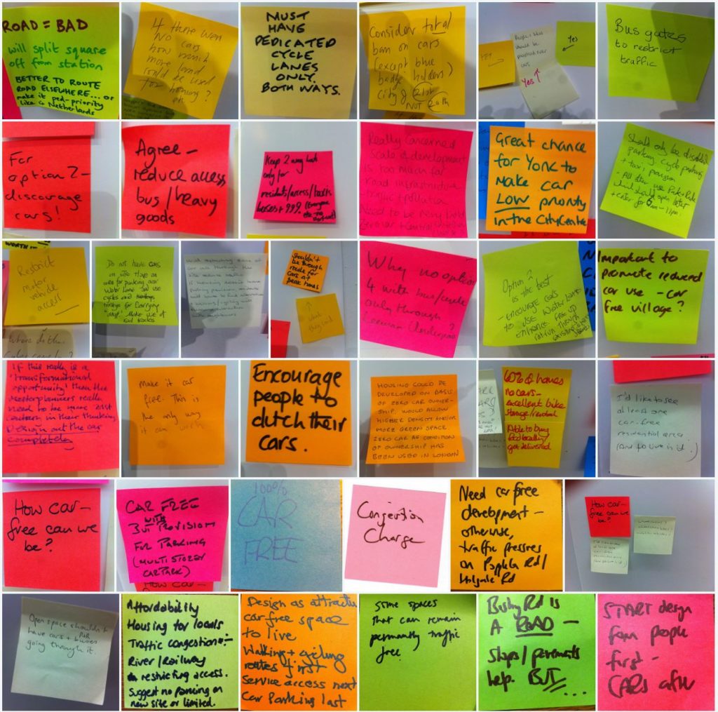
Post its of key ideas noted at the workshop with Tony May.

Wednesday 11th April, 7:00pm – 9:00pm
National Railway Museum Gallery

York resident Dr Tony May specialises in urban transport and has provided advice in the UK, Europe and internationally. He is the transport specialist on York Civic Trust’s Planning Committee. This event included an illustrated talk bringing in examples from the Vauban project in Freiburg to examine how sustainable transport can genuinely form the heart of new development, shaping it and making it a pleasant and more affordable place to live and work. We discussed the current emerging masterplan, how closely this reflects the priorities set out in York’s Local Transport Plan, and how it might be further developed to make both the new development and surrounding existing communities more sustainable.

Presentation
Tony May opened by giving a talk – you can read his presentation here.

Questions
There were then a series of questions from the audience.

Q: Vauban – how does the parking work?
Residents can choose to have a car, but if they have one they have to pay for a space in one of two multi-storey car parks. They pay the actual cost of provision (land & construction) which is between €18,500-€22,500 plus a monthly service charge. Car ownership is 160 cars per 1000 residents, compared with 299 elsewhere in Freiburg. There is evidence of a trend towards car ownership being less important for young people, they are interested in alternatives like car clubs and car sharing. In inner city areas, high quality public transport can encourage people to leave their cars.

Q: What about deliveries in Vauban? What if you were having a washing machine delivered?
In central London a landowner I am working with managed to reduce deliveries by 50-70% by having a central pick up point. It wouldn’t work for washing machines but then we don’t get washing machines delivered every day.

Q: Leeman Road traffic, where will it go?
There is interesting research which says that if you reduce roads then some of those journeys just don’t happen – or they happen in different ways. But knowing what people are doing instead is difficult to research. You can increase the capacity of the road network through some tinkering in order to ease congestion, as we’ve shown with the Fishergate Gyratory.

Q: I want to be able to drive down Leeman Road, not to get into the centre of York but to get across York.

Q: In terms of parking, there would need to be no on street parking and restricted parking in all neighbouring areas or there is the potential for displacement parking.
If you manage parking then you have to cover an area that is much larger to avoid displacement.

Q: Station plans: if you have a new multi-storey and buses and taxis coming to the back of the station, then all the traffic would still be coming through Marble Arch.
At our meeting with Arup it seems they were planning for a 500-place multi-storey car park, to be shared between NRM and Network Rail. There is also the potential for a multi-storey on the Railway Institute site.

Q: Does it make sense to use existing rails for Very Light Rail?
There has been talk about a Harrogate / Scarborough line (where trains only run once per hour) use of existing rails. But on other lines the frequency of trains is much greater. But Very Light Rail needs significance investment. Where are people coming from to the station, I’ve not seen those figures.

Q: I live 3 miles from York Station and go there regularly for work, but the Park and Ride is just too slow. We need tram or something similar to get people like me out of my car.

Q: HS2 – how does that fit into the future economic development of York?
There is a danger by connection big and dynamic A-type cities (like Manchester and Newcastle) that B-type cities like York suffer. If York is not active in pursuing economic development then HS2 or any increased connectivity will be to the detriment of York.

Q: Why are they doing what they are doing with Queen Street Bridge?
The Council got Yorkshire Transport Infrastructure funding to do a number of things – including the York Central Access route – and the Queen’s Street Bridge was one of them. The money needs to be spent by 2021.

Q: Can we bring trams to York?
Trams in the UK have a chequered history. They have tended to be overdesigned, like in Manchester, and are therefore very expensive. They tend to be privately operated. And they are expensive to get up and running, Leeds has been trying for 25 years. Very Light Rail is being looked at in Warwick University to be tried out in Coventry, this could be lower cost. This would require a conversation with Network Rail. This is something to be discussed in York’s Transport Plan.

Focused small group discussion
We then broke into groups to look at different questions:

Walking and Cycling: What should the networks look like?
• Better walking and cycling connection from Wilton Rise – to then connect into the new Scarborough Railway Bridge was seen as a very good thing that opened up entirely new off road routes.
• Closely Leeman Road was questioned – it is very busy and how can we stop the other new road being through route and 24h access for pedestrians was seen as essential. Rijksmuseum was mentioned.
• Prompted by this we looked at the options for Marble Arch (which ‘is an embarrassment’). It was noted that any traffic that did come through would be driving through the new square.

Public Transport: What should the network look like?
• The network needs new services in addition to re-routing of existing ones. They need to actually stop in York Central, and need to operate as close to 24/7 as possible.
• The network needs to connect both with the broader York and regional network (people want to travel from York Central elsewhere in York, not just to the centre of the city and they don’t want complex/slow connections) and with destinations within York Central such as service points, car club locations etc.
• We need better-designed vehicles so they are seen positively, but they also need all the basics so need to be convenient, predictable, quiet, attractive. Also need to make use of current good technology like contactless and live timing displays.
• We need mixed vehicles to cope with longer/shorter distances, so small for local and bigger for “trunk” routes. Small ones could be “driverless pods” or could be like the NRM road train but electric.
• Trams tend to work well on straight lines, buses cope better with wiggly networks.
• “Sustainability” has to include guaranteed mobility for those with disabilities. Can we have a York Central Dial-a-Ride?

Provision for parking:
• A key driver to the discussion was ‘tomorrow’s solutions, not today’s’. So let’s know assume everyone wants a car. Where will autonomous vehicles park?
• A lot of discussion about the benefit of meeting spaces near to the station (add in post its). It was noted Clifton Moor office space – with a lot of parking attached – was being turned into office space.
• A model like Vauban – with parking on the edge – was broadly supported. Though the group was a bit worried about how Tesco deliveries would be taken in (Tony said, carry it down the street!).

Provision for servicing
• Dedicated cycle routes give options for use as dedicated delivery routes – either with “delivery bots” or simply cycle couriers.
• Trans-shipment involves “double handling” of goods but this is part of the process anyway – we just don’t see it (look at online tracking of any parcel to see how many separate journeys are involved). There are positive branding opportunities in this – M&S can offset extra costs of handling for local transhipment by ensuring the delivery vehicles have “M&S supports local zero-carbon deliveries” all down the side.
• Recycling – needs consideration as part of the design process (keep it close to homes / work) and also management process (how can it be incentivised, like at student halls).

Connecting York Central and Holgate

Friday 13th April
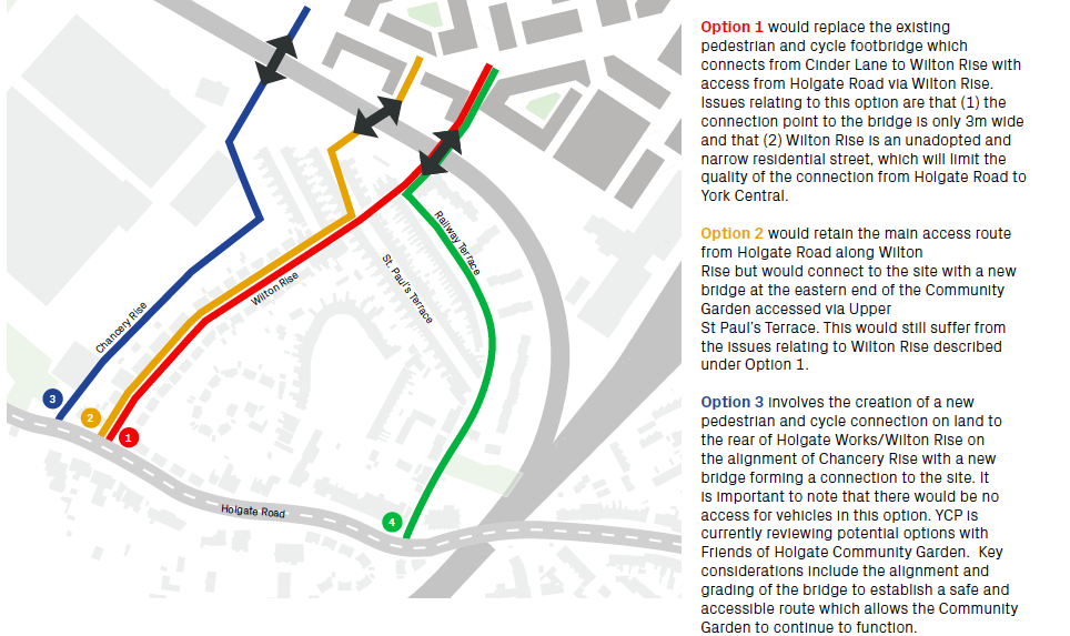
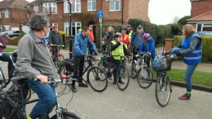
One of the key issues that has emerged from conversations within the Festival of York Central has been connections between the new development and existing surrounding communities. It’s recognised that the existing footbridge across the goods line which connects Cinder Path and Wilton Rise is not ideal, and the masterplanning team are exploring options to improve this connection. These include replacing the existing bridge with something better in the same location, providing an improved connecting route, replacing the bridge in a new location, or doing nothing. The aspiration would be for the new bridge to be more usable for cyclists, for wheelchair users and for those with prams and push chairs. We leafleted all properties in the area and then in collaboration with the friends of Holgate Community Garden, walked the routes to take a look at the options.

Throughout the conversations there were some “bigger picture” questions raised:

‘What will be the increase in volume of walking and cycling? Who will be using the routes when the development is completed? We need to have all the information in order to make a decision’.

As well as some statements of principle discussed:

‘York Central shouldn’t be to the detriment of the people who already live here’.

We have then organised the responses underneath the four options proposed in the York Central masterplan.

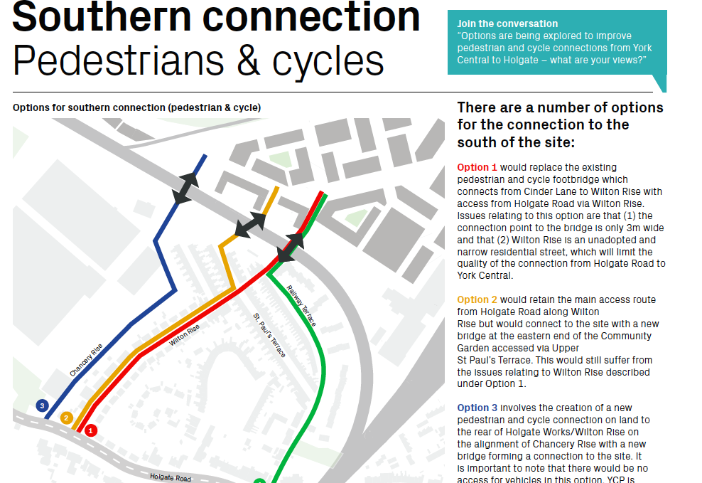
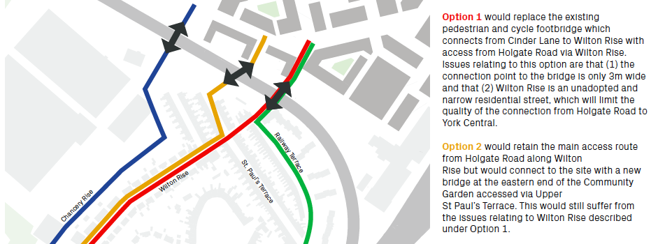
Option 1 is the red line on the map.

Option 1: Wilton Rise, replace the existing bridge.

‘Could the bridge widen out from the south as it crosses the railway?’
‘It’s got busier, the bridge can’t cope and it’s affecting residents’
‘Lots more bikes and lots more pedestrians – I’m not sure the surroundings of the bridge can sustain that, screeching bikes, noisy roller suitcases, high heels. The streets are narrow’.
‘I didn’t envisage when I bought the house that it would be a thoroughfare into town’.

As you can see from the information, one of the issues raised for any route was whether it goes through the unadopted Wilton Rise. Being unadopted means the residents and not the council are responsible for maintaining the street. Currently there are a number of potholes and cracked pavements.

It also restricts the possibilities for restricting/controlling parking. ‘We will soon have residents parking (Respark) in the terraced streets near the bridge but not on Wilton Rise as that is an unadopted road’.

Option 2 is the route indicated in yellow.

Option 2: Wilton Rise, new line for the bridge.

‘It is a bit bonkers’
‘This location for a bridge is something people didn’t sign up for when they moved here’
‘It depends on what would be on the other side – would it be bars?’
‘So the new empty offices will go there, will they?’
‘How high will the buildings be on the York Central side?’
‘This is a great view of the Minster – but not an “acknowledged” view’
‘This option doesn’t solve the Wilton Rise issue’.

The question remains in terms of volume of cyclists and pedestrians.

Option 3 is indicated in blue and shows a new route up Chancery Rise.

Option 3: a new path coming up Chancery Rise leading to a new bridge
This Option 3 follows the line of one the proposed routes for a new access road (the final access route chosen was the one from Water End via Millennium Green).

In principle there was an interest in the positive aspects of more people using the Holgate Community Garden and good use of any cycle path:

‘This is an “asset of community value” garden – we want people to use the garden’.
‘The more people that use any new cycle path – and the garden as well – less chance for anti-social behaviour’.
‘We want the garden to be put on the map and be better used’.

But there were some specific concerns and some specific requirements that would need to be taken into account:

Where exactly will the route go:
‘There is a massive height difference so they’d have to start ramping it very early’.
‘The worry is they will start shaving bits off the garden and play area. It’s been a long fight to protect this’.
‘There is perhaps the piece of waste land on the other side of the fence (and the basket ball court)’.
‘The bike path would not be overlooked here (to the rear of and below the Wilton Rise gardens– so it would need to be very well lit at night’.
‘We wouldn’t want to lose the trees. The trees are useful for shading and reducing noise, we’d want to keep the trees.’

Any option would need to take into account and build on the Holgate Community Gardens specialness:
‘At the moment this works well as an enclosed space where children can run around without them wandering off’.
‘The basketball court is used by groups including by the school for PE, so that would need to be kept’.
‘The residents of the area, would want ‘to get onto the cycling path at the end of the garden’ – but want the point above noted in terms of the benefits of enclosure.

Option 4 didn’t seem overly different or worthy of specific discussion as it was effectively the same as Option 1; and proceeding as if people wouldn’t use Wilton Rise if that was their shortest route didn’t seem useful.

Other options:
‘Is there another option which is further along (beyond the Holgate Works, where the business park is). The benefit would be not having to come up (the line of the railway) to go back down again.’ This had also been mentioned previously as a good link between the development and Acomb’s shops/businesses.

Notes on cycle routes:
The rejection of Option 4 was in part as a result of feelings about marked cycle routes. The streets have little vehicular traffic but a lot of parking, meaning the pragmatic safest route is often straight down the middle of the road, in order to give best sightlines for any emerging traffic and to keep clear of opening car doors. There would be little point in marking a cycle route on either side of any of the roads as it would be ignored.

Final thoughts:
• Adopting Wilton Rise: It seemed as though the recent adoption offer to Wilton Rise had been unattractive for the residents as there was an initial payment to cover assessment which would be followed by an unknown amount to bring the road up to standard before adoption. Could this offer be revisited as part of these masterplan discussions?
• Is connectivity always good? There has been an assumption that connectivity is good but there were voices of concern about great connectivity to the new community that York Central would bring. A question raised is how to recognise that communities need some kind of boundary and yet also create routes through…how do we design for both?

What Makes a Good Cycle Route? A ride with York Cycle Campaign


Saturday 14th April 2:00pm – 4:30pm.

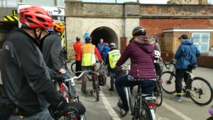
The proposals for York Central – like almost every new development today – talk about “encouraging walking and cycling” and refer to “high quality cycle infrastructure”. But what does this actually mean – what makes a good cycle route and hence a good cycle ride? What can we learn from York’s existing infrastructure in order to make York Central a place where people want to cycle? We explored these questions through a guided ride led by York Cycle Campaign, exploring the roads and cycle paths of York. We looked at cycling infrastructure proposals for York Central and – with the experience of our ride fresh in our minds – discussed whether it will encourage us to cycle there.

The mix of bikes, and indeed riders, was broad. From a Brompton folding bike via various town and road bikes to heavyweights including an Elephant Bike and a few Gazelles, we also had one rider on a recumbent, and one rider aged ten. We were joined for the latter part (and discussion) by two younger children and a disabled rider on an adapted e-bike.

We kicked off the discussion by exploring which part of the route we enjoyed the most:

Most pleasant parts of the route

‘The New Walk cycling route feels like a useful route’

‘New Walk acts as a spoke into the city’

‘There is the factor that some routes become less attractive in certain weather or at different times, like at night’

‘How long after floods does it take to be cleared? It takes two or three days to clean it, depending on how likely it is for the rivers to come back up’

‘I enjoyed Hob Moor, it’s very useful for Holgate/ Acomb as a safe route’

‘It made a difference where there was a green filter reservation space where cyclists can go first’.

What did people find the most frustrating part of the ride?

‘Pot holes. They fill them in, but they fill them for a car and not for a cyclist – they end up as humps’.

‘I’d forgotten how bad Wilton Rise is – because it is unadopted’

‘Wilton Rise is part of the designated cycle route’. (It is unadopted but it was resurfaced by the council on a one off basis, following deterioration caused by utilities works).

‘I didn’t like crossing Leeman Road to get to the Scarborough Bridge – you need to get to the traffic island and you have to wait there and the traffic island was not very big at all’.

‘Getting across to Marble Arch from Cinder Path it’s not at all clear where to cross the road’.

Ouse Bridge: ‘Saturday afternoon is never a good time for cycling’.

‘The pavements get very busy and so people step out without looking’.

‘Ouse bridge – I feel quite squeezed out as a cyclist’.

‘It is very tight’.

‘That’s where all the drunk people are’.

‘Getting across main roads (Butcher Terrace, Leeman Road) was an issue. They were the points where we got broken up as a group’.

‘The gates and cattle grids on Hob Moor are appalling, we could make them more cycle friendly’.

‘Making a good cycle path should be about removing barriers and making is easier’.

‘Residents are able to get keys to open side gates – but this is not well advertised’. ‘Opening a gate would not be easy for people with disabilities’

‘There are genuine issues with cows and mopeds but there must be other ways of doing this – let’s explore how other places tackle this. Town Moor in Newcastle?’.

The York Central overall movement strategy:

‘All the routes are in the same place, the cycle route would be along the same route as the road route. There would be little separation.’

‘We need to have people being able to cycle in opposite directions, including with tricycles or trailers’.

‘I wouldn’t mind having a longer route, if it was separated. In Munster they have a perimeter route around the outskirts of the city centre, it is not the most direct route but there is certainty about how to use it and it takes some of the discomfort out’.

‘Half the problem with getting people to cycle is feeling safe – the safer people feel the more likely they are to cycle’.

“How will cyclists feed into Water End?’ ‘The access route will be worked up in detail for the outline planning application’.

‘There are not many access points into York Central. Routes across are crucial to make it feel connected’.

‘Access to the station is important, if you live in Holgate you don’t want to go all the way round to get the station’

 In York Central, is it a leisure route or commuting? ‘There are different purposes to cycle routes. I wouldn’t choose New Walk if I wanted to get there quickly’.

Who will own the public space in York Central?

York Central plans – Marble Arch and Leeman Road Tunnel:

  • Option 1: Do nothing
  • Option 2: Marble Arch as pedestrian tunnel, half of road two way cycle route, other half light-controlled alternate traffic route
  • Option 3: Marble Arch as pedestrian tunnel, cyclists and cars together on road through tunnel.

Can there be an Option 4 of ‘ban cars’ with a bus gate?

‘It is very important that people indicate Option 2’ ‘But Option 2 isn’t ideal’.

‘Surely you can’t do that because of car access to the NRM?’ ‘but you can get there the other way via the Water End access route’

‘What about putting the pedestrian route within the tunnel on the existing footway next to the cars?’ ‘It’s not wide enough. What about push chairs?’

York Central Plans – Proposed southern pedestrian / cycle route from Holgate

We discussed the various options for Wilton Rise. We looked at Option 3, which would be a more secluded route, would that be okay?

‘Cinder Lane, became better once they removed the walls – it felt safer. I don’t feel unsafe if I’m cycling – you don’t stop so that’s fine – but I would not cycle over Scarborough Bridge as it is currently. You’re more vulnerable there’.

‘If it is well designed and well lit – then it will be well used and safe’

‘If you feel safe then you use it’

‘Marble Arch was well lit and that made a difference’.

York Central Plans – access through NRM if Leeman Road is closed off

‘I think it should be permanently accessible route for pedestrians and cyclists’

‘Being shut at night will reduce accessibility. It would be like not having the Millennium Bridge open at night’

‘It would contradict the desire for connectivity’

We then shared the information about time taken on the proposed diverted routes, with the suggestion that it is only 2-3 minutes extra…

‘But if you are in a wheelchair or with a strict time limit then three minutes is significant’.

‘It is the psychological side, it is about people who live here feeling they are connected to the city centre’.

‘If it feels like private space that is closed at night then you will feel cut off’.

‘If people don’t use those routes at night then it becomes more dangerous’.

Overall – what makes a cycle route pleasant?

Is cycling by a park a positive thing or, after dark, a negative thing?

‘Lighting and space is important’

‘Bushes and trees during the day time might look good but at night, low foliage next to the park can make it feel unsafe’

‘Clear lines of sight make people feel safe and therefore they will use the spaces more’

‘You can use light to make a path feel safe at night, you don’t have to remove all vegetation’

‘You can use landmarks that gives it a sense of being a place’.

‘You need good way finding facilities as well’.

‘Some kind of route into the NRM, with some sort of historical trail. That was the reason for stopping at the Hob Stone on our ride. A good ride is one with a sense of place’.

How should we maintain cycle paths?

A member of the group is a volunteer on Sustrans paths – where they clean up glass as well as cut back vegetation. He asked ‘would a team of volunteers who might live on York Central, end up being responsible for doing that – or would the council?’

‘On the cycle path that goes through Derwenthorpe there was a lot of litter and the residents are taking it on themselves to do litter picking along that route. A good cycle path is one with litter bins on the route’.

‘It has got worse the last few months – part of that is budget cuts’.

‘Low shrubs are a bit too good for holding litter – and make it hard to get out’.

Another member of the group asked: ‘Why should it fall to volunteers, if that was a road it would be maintained?’

‘The Sustrans routes are different they are owned by Sustrans’.

‘Where the paths are council owned and adopted, if there is broken glass the council will remove it if reported’.

How / do we share space between pedestrians and cyclists?

 We talked a lot – having experienced a couple of stretches of shared space on New Walk and Kings Staithes – about whether – and how –  space can be shared between pedestrians and cyclists:

 New Walk is better defined but after Blue Bridge ‘should be better defined’

‘It is a good idea to keep pedestrians and cyclists separate – Kingsway North is a good example’

‘I like routes that are clearly for cyclists or clearly for pedestrians. The one on Clifton Bridge is meant to be cyclist only but it’s not clear to pedestrians. I like them with a white line and where its two way for cyclists and then it feels dedicated’

‘We could change the colour for cycle paths’ ‘…but the colour comes off easily, as do the white markers’

Others felt that shared space can work:

On New Walk, ‘I think it is clear that it is shared space’

‘There were two children who were in danger of being injured as they were wandering around’

‘Cyclists need to slow down and cycle sensibly’. ‘In shared space cyclists need to slow down’

‘I was having trouble cycling through the crowds of walkers, then I joined the group and that was much easier‘

‘Cycling in this country became aggressive because they had to fight for space…’ ‘But it doesn’t help…’

…and possible ways of managing shared space better:

‘When we did the ‘Secret Life of York’s Public Spaces’ event we looked at shared space – especially the shared route past the Minister. What we thought worked well there was that there needed to be very generous shared space with enough room for cyclists to cycle around pedestrians’.

‘Shared space needs legibility – you need to know you are in shared space’

‘Shared space is great if you are out for a leisure cycle ride but if I am commuting then I want to go fast’.

This suggests a possible idea to develop further: that different type of use needs to be separated, not mode (walking or cycling). Direct cycling routes should perhaps be separated from pedestrians but where the focus is clearly more about leisure, then maybe separating out walking and cycling is less necessary – given enough space.

Final thoughts: Principles of what makes a good cycle route:

  • Types of use: Cycle routes for people to get on for a hurry – straight and clear (direct commuting). Shared spaces where there is an understanding of more relaxed use (leisure)
  • Priority: Cycle routes generally should have priority over side junctions – a straight, level route across junction mouths rather than having to follow the kerb around the corner. ‘You want to have priority and not be worried about checking for vehicles turning left’.
  • Routes should be legible and have clear waymarking, and be continuous.
  • Routes should not require cyclists to dismount at hazards.
  • Where cyclists have to cross busy roads, signalised crossings should be provided.
  • Cycle parking should be provided at likely route destinations.
  • Cycle routes must be maintained properly (to a higher standard than the general highway since the impact on safety is greater) and must be cleared of snow / ice / mud / vegetation promptly when required.

Open Briefing Document – Movement

Week 4 of the Festival of York Central was focused on ‘movement’, asking how people wanted to get to, across and around York Central. We’ve gathered information through social media and through a series of events:-

  1. Beyond Flying Cars – sustainable transport on York Central – joint York Environment Forum / York Bus Forum open event
  2. Getting Out More – family drop in workshops leading to production of a zine
  3. York Central Transport & Access with Professor Tony May
  4. Connecting York Central & Holgate – walk with local residents re proposed southern pedestrian/cycle access routes
  5. Out and About workshop sessions with pupils of St.Barnabas and Poppleton Road schools
  6. What Makes a Good Cycle Route – guided ride and workshop with York Cycle Campaign
  7. Pulling together the Week’s Conversations – public workshop (with The Life Sized City film show)

We have also drawn upon movement-related discussions during previous weeks – for example on issues of legibility in shared space (from our Open Spaces discussions) and the role of transport in urban development (from the David Rudlin workshops). In addition, tagging of comments from previous events has allowed us to put responses from the week’s events in a broader context of overall comment, questions, etc.

Here are the main issues and comments:-

Some key principles:

York Central cannot be seen in isolation. One of the recurring themes of discussions on movement was integration – transport modes and routes need to connect to make them useful. A truly high quality transport network on York Central needs to integrate with a truly high quality transport network across the city. So:-

  • People felt that York Central should set an example of innovative, forward-thinking sustainable transport and…
  • York Central should be an opportunity to leverage change across the city and bring forward broader innovation – for example new networks (Very Light Rail, continuing through the city and onwards to Heslington / Elvington) and processes (freight trans-shipment for local deliveries, with small electric vehicles / cycle couriers).
  • We should design for behaviour patterns that we want in future rather than just to work with current patterns (for example prioritising active travel).
  • Prof Tony May set out the hierarchy of priorities within the draft Local Plan and stated clearly that design of movement infrastructure within York Central should reflect this, with clear and convenient walking/cycling routes occupying space best suited to them, and vehicular routes elsewhere. This was widely supported.
  • There should be better separation between vehicular routes and cycling routes – these should be truly segregated (not immediately adjacent) and walking/cycling routes should always have priority.

The need was identified for good-quality information to steer future decision-making. For example:-

  • What will changes in overall age of population mean for transport demand? Will there be more people with mobility issues? More mobility scooters?
  • Can we obtain information about what journeys people want to make (not simply traffic counts on roads – information about “why”) so we can consider and design for end-to-end journeys?
  • What is the basis for decision-making on car use/ownership? Is this simply the status quo (“most people have cars, so we design residential areas for cars since moving away from this would result in resistance”) or is this on the basis of alternative possibilities (“there must be lots of people for whom a car-free neighbourhood this close to the centre would command higher house prices”).

Reducing movement by reducing zoning

Can we reduce the need for people to move around by the way we plan the development?

“We thought the future would be working from home and having meetings via Skype; do we no longer believe that we’ll all be working from home?” “It’s not become an either/or, people are not using it as a replacement”.

There seem to be movement implications from this as follows:-

  • Working from home will still require movement but this can be largely walking/cycling
  • Small/medium businesses (for example creative industries) often involve “clustering” where good local connections (again walking/cycling) are important.

Public transport and the rest of York: Ease of use and Integration

  • Seamless connections with a wider network are needed to allow necessary longer journeys – simply getting to the city centre is inadequate if onward connections aren’t easy and fast.
  • This needs to consider both the radial routes and movement between them – York is poor for this.
  • Ease of use is essential – contactless payments on all transport modes, and operating times / pricing models which suit users rather than just operators (current Park & Ride arrangements were frequently criticised).
  • All of which points to a requirement for some over-arching strategy and an appropriate body to administer it, an equivalent to Transport for London – Transport for York – was mooted.

Pedestrian and cycle movement

Key points were that:-

Cars on York Central: Low car development and no through traffic

A crucial choice is whether there is through traffic across York Central. One comment was “If you allow through traffic, this is where all ideas of being radical evaporate”.

Many people noted that there seemed to be an assumption that “restricting car use/ownership” was seen as problematic and would decrease the appeal of living/working on York Central, but that this was open to challenge. There were many suggestions that a car-free neighbourhood would be very popular and would command premium prices. “People will have a choice – no-one is being forced to live here”.

Prof Tony May set out a proposal for York Central based upon the Freiburg Vauban development – allowing car access but with centralised parking, creating Play Streets and safe walking/cycling routes. It was noted that this would require consideration (for example Respark areas to prevent “overspill”) beyond the site. This side-steps the “ban cars” challenge by allowing ownership but passing on real costs and making alternative modes more attractive.

Prof May’s ideas envisaged centralised parking at the north-west end of the site, close to the access from Water End. Bringing cars deep onto the site to multi-storey car parking adjacent to the station was felt to be a backwards step, which would greatly reduce safety within the development. Parking for service use (tradespeople etc) was discussed and it was felt bookable spaces could be provided. Local deliveries could be to service points, combined with public transport stops or parking areas.

Marble Arch / Leeman Road tunnel: How to avoid traffic cutting up the New Square

People stated that the main access to the site (and NRM) from the city needed to reflect the City’s transport priorities – it should be a good route for those walking / cycling etc. Its poor visual appeal was noted and the question was asked “what would it take to turn it into the gateway to a major museum?”

The impact of through traffic on the new square was frequently mentioned. Both two-way through traffic and light-controlled alternate traffic (Option 2 on the Marble Arch board) were thought likely to lead to queuing traffic in what has been described as a pedestrian civic space, which should be avoided. Traffic was furthermore seen as a potential barrier between the NRM and the station / city centre.

National Railway Museum through access: A creative opportunity to celebrate movement

There was almost complete opposition to the closure of Leeman Road to pedestrians/cyclists outside NRM opening hours. It was noted that modelling suggests it would take people on foot 1.5 to 3.15 minutes longer when the museum was closed. There were comments like ‘it’s not about how much longer it will take’, ‘it’s the psychological factor of feeling cut off and that the museum is blocking you’.

More positively, there were comments like “I don’t think it’s about the time saved or not, it’s about the experience and qualities of being able to walk and cycle through the museum”. There were repeated requests for a more creative solution which celebrated movement (“it’s bizarre that a museum of movement would cut off movement”) and the Rijksmuseum in Amsterdam was cited as a good example of what could be possible, with new opportunities for the public to see exhibits while maintaining out-of-hours security. Creative possibilities were identified around rotating doors or a turntable in the link building – “like the Gateshead Millennium bridge – people would come to watch it open!” and “the shadowy trains in the closed museum are far more atmospheric than when it’s open”.

Connections to existing communities

There has been an assumption that York Central should connect to surrounding communities but this was noted to have challenges:-

  • The simple fact that people who are used to being disconnected from public movement may be suspicious of change
  • Issues to do with alcohol and antisocial behaviour – new bars in York central leading to hen parties making noisy progress through surrounding communities
  • Places which offer security (for example Holgate Community Garden) becoming open and routes for (pedestrian/cycle) through-traffic.

There was a broad point made that the development needs to provide positive benefits for existing nearby residents and needs to clearly spell these out. “You compromise. Part of this is “I’m not going to get that bit that I really want but I’m going to get that other bit instead”. There has to be a quid pro quo”. This applies to movement as well as other facilities.

Discussion of the proposed southern connection is covered in a separate document.